The Dalia Field
Analogue Spotlight
Located offshore Angola, The Dalia field produces hydrocarbons from Miocene turbidites of the Malembo formation. The reservoir’s intricate structure consists of channel sandstones that formed as a result of lateral migration and vertical stacking of deep-marine turbidites, creating a labyrinth-like architecture.
To effectively produce from this reservoir and mitigate production declines, early interventions such as water and gas reinjection were implemented shortly after the field came onstream, while horizontal drilling further improved recovery. However, to properly define reservoir architecture and determine changes in fluid distribution resulting from reinjection, a more advanced approach was required.
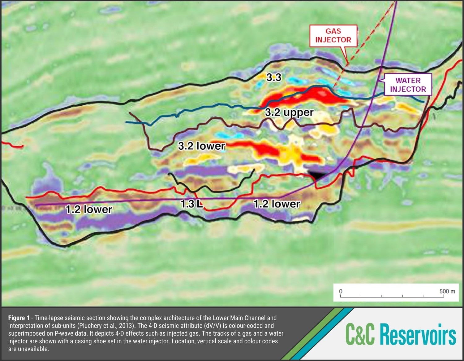
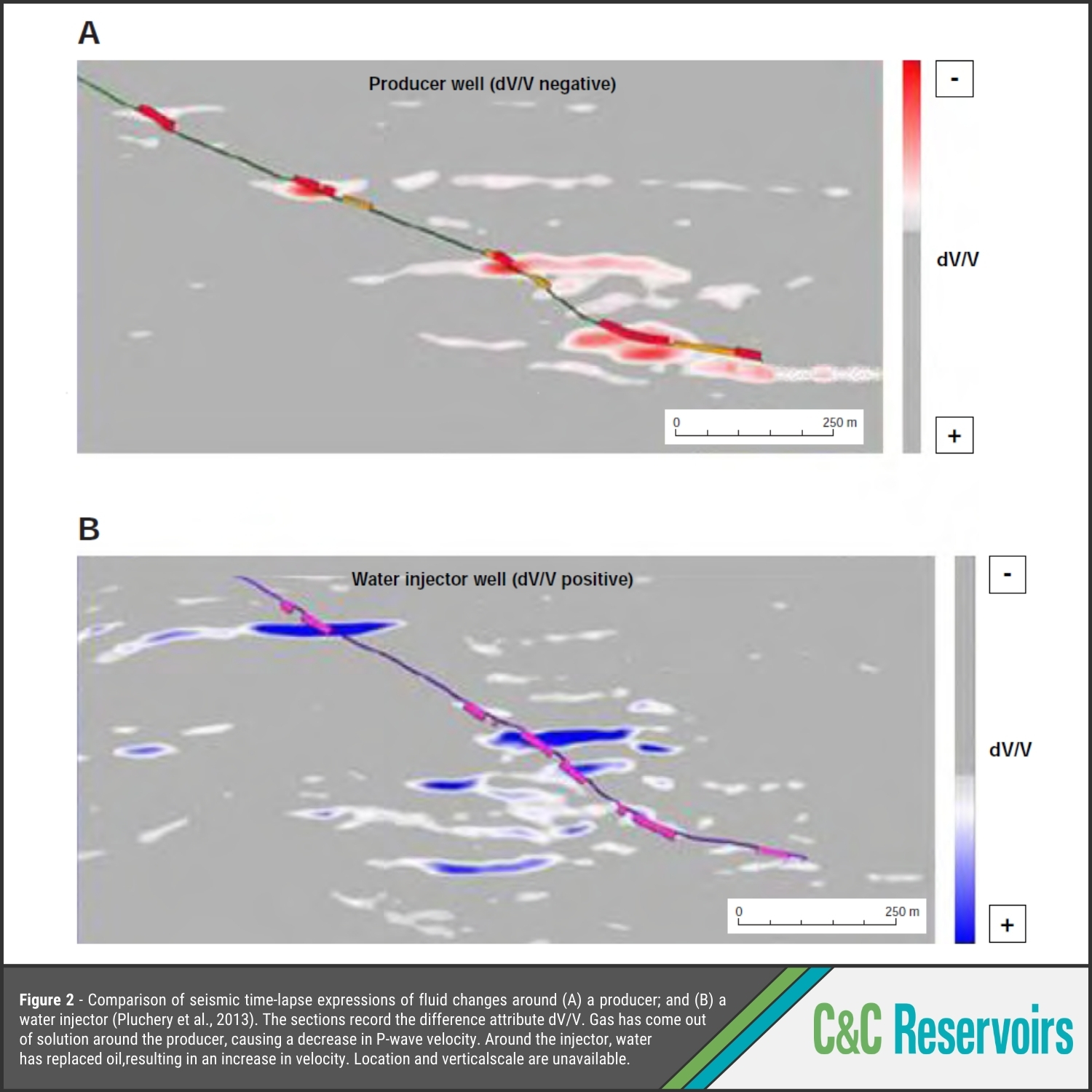
Enter 4-D time lapse seismic imaging – an innovative technology at the time of the baseline study in 1993 that dramatically improved the ability to image and interpret Dalia’s complex structure. This method allowed operators to visualise the movement of injected fluids through the reservoir, tracking them across time and pinpointing their exact paths (Fig. 1 and Fig. 2). Equally important, this technique provided a view of pressure variations surrounding producers (Fig. 3), creating a dynamic picture of reservoir conditions.
When combined with traditional production logging, 4-D imaging proved to be a powerful tool in optimizing well placement, enabling horizontal wells to be drilled with precision based on the most current fluid distribution insights.


References
Pluchery, E., Toinet, S., Cruz, P., Camoin, A., and Franco, J., 2013, Intensive use of 4D seismic in reservoir monitoring, modeling and management: the Dalia case study: International Petroleum Technology Conference, Beijing, IPTC 17047, 6 p.
Yuh, S., Buré, E., and Alabo, D., 2017, Multi-vintage time-lapse interpretation method used to understand dynamic behaviors of deep-water turbidite reservoirs in Dalia field, Angola: 79th Conference & Exhibition, Paris, B1 05, 5 p.
